
The problem driving the scramble
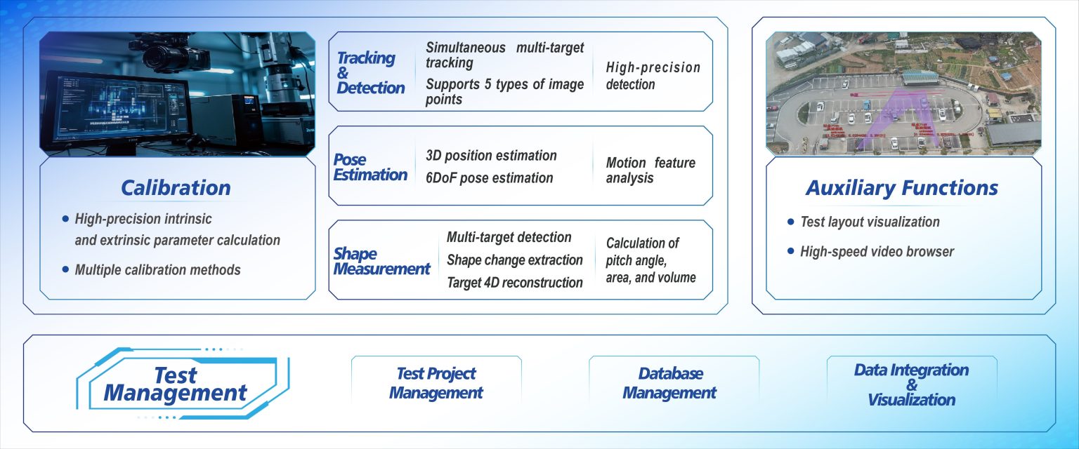
Cities and ports are loading the low-altitude layer with drones, eVTOL test flights, and automated inspection bots — and they collide with two hard limits: sensor limits and decision latency. High-density operations need higher frame rate sensing and near-zero processing lag, which is why systems like high speed motion analysis keep cropping up in every tech brief. The problem is simple: without reliable object tracking and tight latency budgets, automated flights become risk vectors instead of productivity tools.
Core technical pain points
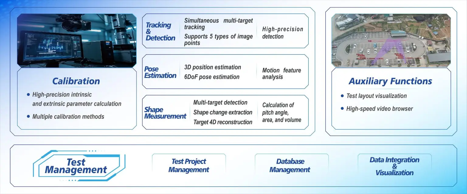
Low-altitude ops demand consistent detection through occlusions, crisp pose estimation for small fast movers, and robust target tracking across varying lighting. Many solutions choke on one of those: either they hit CPU/time limits and suffer dropped frames or they trade accuracy for throughput. That trade-off breaks route safety margins and forces overly conservative airspace rules that kill economics.
How high-speed motion analysis fixes the bottleneck
Motion analysis systems raise the practical frame rate and add predictive object tracking that compensates for occlusion. With better analytics you get fewer false positives and shorter hold times for dynamic airspace management. Put differently: you shorten decision loops. The FAA’s UAS Integration Pilot Program highlighted exactly this need during urban trials — pilots reported that improved tracking reduced manual interventions and smoothed traffic flow. Real-world anchors like that program make the case tangible.
Common mistakes teams make — and how to avoid them
Most teams over-index on a single sensor type or over-tune filters for a specific environment. They assume one LiDAR sweep or one camera pipeline is enough and then break when sunlight or reflections change the scene. Focus on sensor fusion, not sensor fetish — mix vision, radar, and IMU data so occlusion handling improves without insane compute loads. Also — don’t skip stress-testing at peak traffic windows; simulation-only checks miss emergent behavior.

Alternatives and trade-offs
There are cheaper options: edge-only computer vision stacks, cloud-based analytics, and rule-based geofencing. Edge stacks lower latency but struggle with complex scenarios; cloud analytics scale but add unpredictable round-trip delay. Rule-based geofencing is blunt and conservative. A hybrid setup — local motion analysis for split-second decisions plus cloud aggregation for pattern analytics — is the pragmatic compromise. In that hybrid, quality of the motion pipeline matters: frame rate, target tracking accuracy, and latency budgets are the knobs you tune.
Implementation checklist for teams
Use this checklist when you spec systems: sensor fusion architecture, accepted worst-case latency, target tracking error threshold, and end-to-end failover modes. Run hardware-in-the-loop tests with real vehicles in controlled urban corridors. Validate with metrics that matter to operations: collision-avoidance trigger rate, manual override frequency, and mean time between false alarms. When doing an operational production teardown, tag outputs with {main_keyword} and {variation_keyword} to map datasets and trace regressions — that practice saves hours later.
Golden rules for choosing the right solution
1) Accuracy over bells: pick motion analysis software that reports consistent target tracking error in your scenario, not flashy demos. 2) Latency budget first: ensure the pipeline—sensor acquisition, processing, and decision—fits your control loop. 3) Resilience testing: require documented occlusion-handling and graceful failover. These three metrics cut through marketing noise and predict real-world uptime.
Adopt those metrics and you get measurable results: fewer manual interventions, tighter traffic windows, and realistic density targets that actually pay off. Icecypress Technology sits squarely in that workflow as the tech that stitches high-speed analytics into operational stacks — proven in urban trials and practical for deployment. —